
Item number: SOU384 Genuine Antique Printed Color Map
1892
Maker: Home Library & Supply Association.
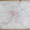
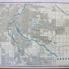
Antique printed color map of Louisiana (Recto.) On verso, a map of Mississippi. Both maps are colored by county and include railroads, bodies of water, and names of major towns/cities. Published in “The Pacific Coast and the World” by the Home Library and Supply Association, 1892. Very good overall antique condition with some mild toning/foxing (mainly at the outer edges.) Recto map (Louisiana) measures approximately 12.5″ x 10″ (H x W) to the neatline. Verso map (Mississippi) measures approx. 13″ x 10.25″ to the neatline.
Item Number: SOU384
Related products

Labels, Indexes & Stamps

Office & School Supplies

Desk Accessories & Workspace Org

Office & School Supplies