
Item number: ASI288 Genuine Antique Printed Color Map
1881
Maker: Johnston.
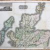
Antique printed color map of the Southern portion of the Indian Subcontinent. Includes the Lakkanav Islands (now called Lakshadweep) and Ceylon (Sri Lanka), as well as an inset map of the South-Eastern Provinces of India. Very good condition, with slight toning at the edges. By A. Keith Johnston, in The Handy Royal Atlas of Modern Geography, 1881. Approximately 12.75″ x 16.75″
Item Number: ASI288
Related products
-49%

Envelopes, Mailers & Shipping Su
Original price was: $5.90.$3.00Current price is: $3.00.
-49%

Desk Accessories & Workspace Org
Original price was: $9.90.$5.00Current price is: $5.00.
-47%

Office & School Supplies
Original price was: $1.90.$1.00Current price is: $1.00.
-48%

Desk Accessories & Workspace Org
Original price was: $3.85.$2.00Current price is: $2.00.