

Item number: MAT157
Genuine Antique Hand Colored Map
1872
Maker: Walling and Gray.
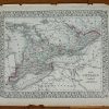
Double-sided page of maps. This antique, hand-colored page of maps was published in the 1872 “New Topographical Atlas of the State of Pennsylvania with Descriptions Historical, Scientific, and Statistical,” by Walling and Gray. This map shows street names, important structures, major features, and details railroad stations and parks. Inset chart shows population by ward. This is a double-sided sheet: the centerfold map is Philadelphia and the back sides are City of Lancaster and City of Allentown. This map is in very good antique condition overall, with some minor stains in margin. Philadelphia map measures approximately 17.5 x 26.5 inches. Verso maps are approx. 13 x 12 inches to the neatline.
Genuine Antique Map from 1872
Item Number: MAT157
Related products

Office & School Supplies

Office & School Supplies

Labels, Indexes & Stamps

Forms, Recordkeeping & Money Han
Kuromi Cheeky But Charming Coin Bank With Lock Cheap Sale Countdown Package